Sweden Secure Tech Hub

Sweden Secure Tech Hub

A national innovation hub for cybersecurity

Sweden Secure Tech Hub is a national alliance of science parks with the mission to improve secure digitalization in Sweden.

By joining forces we aim to lower the threshold for startups, scaleups and SME’s to approach and implement cybersecurity measures and strategies.

Through our science parks Sweden Secure Tech Hub will offer a full range of services to help companies build cybersecurity readiness without investing more than their own time. Beyond the standardized program for SMEs each science park has something unique to offer depending on the needs of the companies.

The key objective for Sweden Secure Tech Hub is to increase the knowledge and understanding of how cyberattacks and cybersecurity can affect business progress in both negative and positive ways. The hub will support and work with companies to achieve new internal processes, policies, guiding principles for future development and tools to test and validate new products and services.

Businesses enrolled in the hubs program are welcome to partake in physical and digital seminars, networking meet-ups, educational modules as well as off the shelf services within finance, tech and law.

The initiative is funded by the European Union through the program for European Digital Innovation Hubs (EDIH), Tillväxtverket, regional funding and the participating science parks.


Business development program in Cybersecurity

För en ökad kunskapsnivå och förståelse för de mindre företagens behov och utmaningar av säker digitalisering.

Är ditt företag cybersäkert?

När allt fler produkter kopplas upp och verksamheter digitaliseras ökar både företagets sårbarhet som kraven från myndigheter och kunder. Händelser i vår omvärld bidrar till en allt större hotbild mot företag. Vikten av strukturerad och strategisk cybersäkerhet hos små och medelstora företag har aldrig varit större.

Strategiskt affärsutvecklingsprogram
inom cybersäkerhet.

Ett program för bolag i Stockholm som stärker företagets kompetens och strategiska förmåga inom cybersäkerhet. Genom ökad medvetenhet, kompetens och förmåga inom cybersäkerhet säkrar vi konkurrenskraft och en framtida hållbar tillväxt.

Under programmets gång kommer ni som deltagare få anpassad coaching och utbildning relevant för era specifika utmaningar.  Under fem träffar leder experter inom olika området workshops med fokus på: – cybermedvetenhet – tillgångar och sårbarheter – risk och incidenthantering – organisation – framtid, lagar och standarder.

Vilka företag söker vi?

  • Programmet vänder sig till personer i ledningsposition inom små och medelstora företag i Stockholmsregionen. Vi ser gärna en till två deltagare per företag.
  • Vi välkomnar särskilt företag från medtech/ den digitaliserade vårdsektorn, och Södertälje Science Park riktar in sig på tillverkande industri.
  • Då antalet platser är begränsat och kostnadsfritt, sätter vi stor vikt vid att deltagande företag har ambitionen att fullfölja programmet.

Vad ingår

  • Anpassad coachning och utbildning relevant för era specifika utmaningar.
  • Workshops kring cybermedvetenhet, tillgångar och sårbarheter, risk och incidenthantering, organisation, framtid, lagar och standarder.
  • Relationer med experter inom cybersäkerhet.
  • Möjlighet till individuellt stöd/coaching mellan träffarna.
  • Strategiskt rollspel.

Vid programmets slut har deltagarna fått ökad förståelse och kompetens samt arbetat fram grunderna i en cybersäkerhets handlingsplan för sitt företag.

Partners

Södertälje Science Park

Funded by

Europeiska unionens regionala utvecklingsfond
Region Stockholm

Contact

Richard Granberg
richard.granberg@kista.com

När och hur

Programmet genomförs fysiskt i Kista under våren 2023. i Programmet ingår fem förmiddagsträffar där ni får möjlighet att tillsammans med 10 andra företag utveckla er medvetenhet, kompetens och förmåga kring digital säkerhet.

Träff 1, 30 mars – Omvärld, affärsnytta & deltagarnas mognadsnivå
Träff 2, 20 april – Riskhantering, organisation och kultur
Träff 3, 4 maj – Säkerhetsåtgärder & incidenthantering
Träff 4, 25 maj – Branschspecifik fördjupning – i samarbete med Swedish Medtech.
Träff 5, 8 juni – Systematisk uppföljning & cyberattack rollspel

Anmäl dig redan idag!


Safety Lab

Safety Lab

Ett aktörsdrivet trygghets labb

abc

Lorem ipsum dolor sit amet, consectetur adipiscing elit, sed do eiusmod tempor incididunt ut labore et dolore magna aliqua. Ut enim ad minim veniam, quis nostrud exercitation ullamco laboris nisi ut aliquip ex ea commodo consequat. Duis aute irure dolor in reprehenderit in voluptate velit esse cillum dolore eu fugiat nulla pariatur. Excepteur sint occaecat cupidatat non proident, sunt in culpa qui officia deserunt mollit anim id est laborum.

Project period

2023

Partners

Kista Limitless
Stockholms stad

Contact

Vanessa Ware
vanessa.ware@kista.com


CITYAM

Preparing Cities for Air Mobility – CITYAM

Urban Air Mobility

CITYAM is an innovative project aimed at preparing cities for the future of urban air mobility (UAM) in the Baltic Sea region. With traditional traffic infrastructure reaching its limits, UAM is gaining attention as a sustainable and efficient solution to urban mobility challenges.

13 partners from industry, academia, and cities across Europe are collaborating in CITYAM. Over three years, the project will aim to develop responsible and sustainable solutions for integrating Unmanned Aerial Vehicles (UAVs) or drones into traditional urban mobility systems. The focus is to help cities and citizens adapt to the changes brought by UAVs and to see the possibilities it brings.

Stockholm, together with Helsinki and Hamburg, will play a leading role in the project. The City of Stockholm, Kista Science City, and the Swedish Air Navigation Services are part of the consortium that will be focusing on funding, expertise, and implementation of tests.

To achieve the goal of integrating UAVs into urban transport systems, the project will identify, test, and evaluate solutions for adapting urban planning, evaluating lifting and landing sites, and building an ecosystem that paves the way for drone traffic to become part of a multimodal transport system. In addition, the project aims to develop tools for managing urban air mobility (UAM) and increase the capabilities of public officials in this domain.

The project will also measure the impact of UAVs on public acceptance and develop an ecosystem that supports it. Ultimately, the project aims to enhance public officials’ capabilities and provide them with the necessary tools to manage UAM effectively.

Partners

City of Stockholm
Luftfartsverket
Kista Science City

Funded by

Interreg Baltic Sea Region

Contact

Eleonor Sjödin Turah
eleonor.sjodinturah@kista.com

Summary

Drones will soon be serving customers, citizens, businesses, and authorities with a wide range of revolutionary new services.

Kista Science City hosts one of Sweden’s largest knowledge clusters when it comes to new mobility. A new project will prepare cities for the next phase in this fast-growing drone economy.

Related articles

Navigating the skies: Drones and urban mobility

Safer, more efficient and sustainable cities with the help of drones? At Mobility Day 2023 experts in urban mobility and drone technology…

drone in air

Kista takes the lead in smart drone services

Drones will soon be serving customers, citizens, businesses, and authorities with a wide range of revolutionary new services. Kista Science…

CITYAM

A new project will prepare cities for the next phase of the fast-growing drone economy.

Focus shot of a drone flying in the city sky

Drones – a natural layer in the future transport system

What impact will the new U-space regulations, Sustainable Urban Mobility Planning and UAMs have on Swedish authorities and entities?

drone in air

Nordic drone initiative

A platform for exchange of ideas between the Nordic countries and the rest of the world


SMART

SMART

Intelligent traffic system

The project

Traffic congestion is a huge problem in urban areas. In Stockholm, car owners spend about 16 workdays stuck in traffic each year. Public transport is also affected by this, and during rush hours, bus services can suffer huge delays.

The objective of the Spatial Modelling Analytics & Real-time Tracking (SMART) Mobility Project is to mitigate growing urban traffic congestion challenges and associated issues of environmental degradation, economic inefficiency and negative impacts to the quality of life of citizens.

SMART Mobility will revolutionise the efficiency of traffic and commuting in cities by leveraging the capabilities of new 4D spatial technology and analysis platforms using real-time vehicle location and various movement data.

Several data sets

The project will use data from many different sources, including:

  • Wifi data from Bumbee Labs. Position data is collected when smartphone searches for WiFi-connectivity. Bumbee Labs technologies utilizes this for crowd measurements and pedestrian flow, which is compliant with GDPR regulations.
  • Vehicle data from Ramboll, Inrix and Tomtom. Through GPS, data such as speed and route can be obtained.
  • Crowd data from Tre. Anonymize crowd data obtained from different sources, like cellular data and WiFi.

Project period

2020-2022

Partners

Ramboll
Bumbee Labs
Savantic
Tre
RISE

Contact

Eleonor Sjödin Turah
eleonor.sjodinturah@kista.com

Summary

SMART is a project that aims to create more effective traffic planning, with focus on public transport. The project will result in a prototype for a new platform, where many different data sets will interplay with AI technologies to predict congestion and plan routes accordingly.

The platform

The platform will be open and transparent for information and data exchange. The data sets can then be used for new types of services and applications, such as new routes for public transport and analyzing the size of a bus fleet. Through visualisation, this can be used to plan for a more effective public transport. In the end, this will benefit the end users – the travellers.

The project

The project aims to:

  1. Conduct three use cases in the Kista-Järva area
  2. Build the SMART-platform
  3. Integrate data sets into the platform

The anticipated result of the project is to completely integrate siloed data using 4D location. A real-time, shared and collaborative application platform will give access to multiple stakeholders. Furthermore, SMART will optimize mobility in the existing transportation network on a massive scale

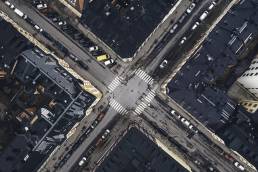
Shot from above of street crossing with cars
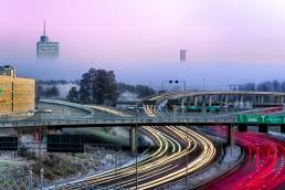
Roads against pink sky and headlight from cars

Subscribe to newsletter

Error: Contact form not found.


drone in air

Nordic drone initiative

Nordic drone initiative

A platform for exchange of ideas between the Nordic countries and the rest of the world

The project

Together with other innovation clusters in the Nordics, Kista Science City founded the Nordic Drone Initiative. This project will strengthen the ties between the different clusters and help companies working with drones to learn from neighbors and form new alliances.

During the project duration, Kista Science City will represent its partners interests in dialogs with the Nordic cluster organizations, cities, and drone companies. The project creates a unique collaboration platform (first of its kind in the Nordics!) to discuss the various use areas for drones in the cities. And as the next step, act upon them through tests in real urban environment, such as Kista.

Partners

VTT, RISE, NORCE, Robots Expert, Bell Rock Advisors, Avinor, Katla Aero, Drone Nord, Gate 21, Mainbase, Flypulse, Nordic Edge, UAS Norway, LFV, Östergötland, Business Tampere

Funded by

Nordic Innovation

Summary

Together with other innovation clusters in the Nordics, Kista Science City founded the Nordic Drone Initiative. This project will strengthen the ties between the different clusters and help companies working with drones to learn from neighbors and form new alliances.

The purpose

  • To identify and evaluate how drones can be used in the transport sector to provide the greatest benefit to society, business and the environment.
  • Map the Nordic ecosystem for drones and the opportunities that this technology provides.
  • Contribute to the development of drone technology for Nordic weather conditions.
  • Propose the development of rule changes that enable drone transports and large-scale operations with vertical take-off and landing.
  • Create a platform for continued research and innovation and developed international cooperation.

Shot from above of street crossing with cars
Roads against pink sky and headlight from cars

NDI members enjoy access to a unique network of drone experts, insights and further research/commercial project opportunities (e.g. H2020) with top Nordic drone organisations. NDI accepts new members with emphasis on commercial actors able to contribute resources in the development work.

Funded by Nordic Innovation

Nordic Innovation is an organization under the Nordic Council of Ministers and aims to make the Nordics a pioneering region for sustainable growth and works to promote entrepreneurship, innovation and competitiveness in Nordic business. Nordic Innovation supports programs and projects which contribute in fulfilling the goals of the Cooperation Program for Innovation and Business 2018-2021 which is decided by the Nordic Ministers for Business and Innovation.


Photo from the side of the blue 5G Ride minibus with cameras on the roof

5G Ride

5G Ride

Autonomous vehicles

The project

5G Ride is a concept for self-driving, 5G-connected electric vehicles used in public transport. 

The purpose of the project is to develop and test connected autonomous vehicles to get closer to an implementation of autonomous vehicles on public roads.

The 5G network’s unique technical features, including enhanced security, extremely high data speeds combined with low latency, means that the connected buses can respond in real time to commands from the centralized control tower.

In 2021, additional funding was added to the project and the focus for the continuation of the project is the further development of the Connected Control Tower. One part of this is how to use more data, for example about the route, the vehicle or the connection strength, to make it possible to prevent any problems, plan routes and schedules better and act more swiftly should problems arise.

Project period

2020-2025

Partners

Keolis
Ericsson
Telia
Intel
Scania
Viscando
T-Engineering
Royal Institute of Technology
City of Stockholm

Contact

Eleonor Sjödin Turah
eleonor.sjodinturah@kista.com

Summary

5G Ride is a concept for self-driving, 5G-connected electric vehicles used in public transport.

Shot from above of street crossing with cars
Roads against pink sky and headlight from cars

The pilot

The pilot in 2020 was the result of a unique collaboration between some of Sweden’s most prominent and well-known organizations within the fields of mobility and technology.

The knowledge hub and testbed Urban ICT Arena managed the initiative, with Keolis as bus operator. Ericsson provided the technical solution for the connected control tower, a solution that will be further developed during 2021.

Telia provideded the 5G-connectivity in collaboration with Ericsson and deployed 5G at Djurgården specifically for this project. Intel delivered analytics capabilities and the technology for the processing across the network including the IT-system in the vehicles and the control tower, as well as the mobile network. T-Engineering, a Swedish technology firm, delivered vehicle and self-driving technology.

HRH Prince Daniel was among the dignitaries to attend the official inauguration ceremony outside Tekniska museet.


Two white cars parked outside

Delta

DELTA

DELTA was a pilot project in Kista Science City, organized by Kista Science City, Ericsson, Intel, Keolis and Telia.

The project

The project DELTA explored the possibilites of on demand last mile-solutions as a part of public transport. The electric cars took riders from door to door and connected public transit hubs with destinations within Kista.

The users was able to download an app and then connect with one of the vehicles in Kista. Both the business district (“Kista Science City”) and the residental area was included in the first stage of testing.

Project period

2021

Partners

Keolis
Ericsson
Intel
Telia

Contact

Eleonor Sjödin Turah
eleonor.sjodinturah@kista.com

Summary

The project DELTA explored the possibilites of ridesharing as a part of public transport. The project was centeredd around Kista in northern Stockholm and offer ridesharing "last mile" vehicles free of charge to users in the area.

Starting point: User Experience

Within DELTA, we focused on the user experience in its entirety to investigate and evaluate customer experience with this unique service in order to find out what attributes the service needs to provide to become attractive to the target groups – in other words, what criteria it needs to fulfil in order for customers to choose it over other first/last mile mobility solutions (micromobility) and private cars.

Testing period

The pilot was launched during autumn in 2020 and continued until early December. The project was funded by Drive Sweden and Vinnova.


The road outside Kista lighted up by headlights of cars passing by

New ways of measuring Traffic Flows and Air Quality in Kista

Combining measurements of traffic flows and air quality

New ways of measuring traffic flows and air quality in Kista

The project

Kistagången and Urban ICT Arena’s testbed provides a great spot for testing new products and cases for a sustainable city. One big challenge for the cities of today is how to manage traffic, avoid congestions and provide a good urban environment.

Planning new traffic solutions and evaluating the effectiveness of changes made to the current environment requires data. In order to provide this, continuous measurements of traffic and the direct and indirect effects of traffic on the urban environment are necessary. By gathering relevant data and analysing them, city authorities may receive better support and bases for decisions, in turn leading to efforts that may lower pollution and reduce noise in the urban environment.

In this project, Edeva shows how combining several data sources at a fixed position in the test bed on Kistagången can contribute to more informed decisions for traffic management. Mounted on a light pole, the sensors measure traffic flow through radar and multi-sensor data, air quality in the form of particles, and noise. Analysing the data provided also makes it possible to draw conclusions about the effects of the traffic.

Project period

2021

Partners

Kista Science City
Edeva

Contact

Lucas Uhlén, Kista Science City
lucas.uhlen@kista.com

David Eskilsson, Edeva
david.eskilsson@edeva.se

Summary

One big challenge for the cities of today is how to manage traffic, avoid congestions and provide a good urban environment. Planning new traffic solutions and evaluating the effectiveness of changes made to the current environment requires data. In a new project in the testbed on Kistagången, Edeva shows how combining several data sources at a fixed position can contribute to more informed decisions for traffic management.

The purpose

The goal is to supply a comprehensive solution to provide municipalities and city authorities with data. This in turn will help with a more robust decision-making process. Measuring both traffic and the direct and indirect effects of that traffic provides better data which makes it possible to measure the effects of introduced solutions and measures to improve air quality and the general quality of the urban environment.

The combination of sensors may also provide insights into the effects of different types of traffic on the urban environment and air quality. The effects of traffic control on air quality and environment will also be measurable. In addition, the tests will provide data on how sensors behave in different conditions, such as light or weather. All in all, this trial will provide valuable data on how to create a secure, stable and cost-efficient solution for data gathering in the future.

Shot from above of street crossing with cars
Roads against pink sky and headlight from cars

Focus shot of a drone flying in the city sky

Vehicle as a Sensor: Air Quality

Vehicle as a Sensor: Air Quality

Mobile Air Quality Sensors Attached to Vehicles in Kista

The project

Air quality is a matter of life and death affecting the daily lives in our cities. When we collect real-time data of air quality in our connected cities, we could contribute to new solutions and prevent illness. Imagine a future where the bus automatically avoids the most polluted streets or if factories limit their production on certain days, thanks to connected sensors.

In Kista, new sensors for local air quality measurement are tested in a number of projects. In the project Vehicle as a Sensor: Air Quality, Edeva and Smart Sensor Devices explored the possibilities of air quality sensors attached to moving vehicles. The goal was to see how mobile sensors can provide data in ways that complements fixed sensors, and how these two types of measurements interact to provide a better picture of the situation.

Project period

2020

Partners

Kista Science City
Edeva
Smart Sensor Devices

Contact

Eleonor Sjödin Turah
eleonor.sjodinturah@kista.com

Summary

Taking advantage of vehicles used in a last-mile public transport project, Edeva and Smart Sensor Devices tested their air quality sensors by attaching them to the vehicles. This gave them the opportunity to measure both indoor air quality in the vehicles and take GPS-positioned measurements of air quality in the urban environment.

Air quality

The project collected real-time air quality data and use software to visualize and analyze the data. This would test the robustness of the sensors and systems, and how this would work in a real urban setting. The sensors were attached to the vehicles used in the Delta project, taking place between October and December of 2020.

The air quality sensors measured two types of air quality. The sensors from Smart Sensor Devices measured air quality inside the vehicles, while the sensors from Edeva measured air quality in the urban environment around the vehicles. The Edeva readings used GPS positioning to keep track of where those readings were taken, and given a time stamp.

Measurements of air quality are important for different decision-making processes regarding traffic and planning of the urban environments. Many measurements are, however, bound to fixed positions, which will give a snapshot rather than a comprehensive picture of the city. Proving the concept of mobile, GPS-positioned measurements taken continuously will assist municipalities and city authorities in complementing their data in order to have a better foundation for future decisions. Indoor measurements of air quality also helps with this process, as it may give data on how indoor environments are affected by the surrounding environment. It also gives important data about the work environment.

Takebacks

One important takeback from the trials performed within the scope of the project was that it proved to be valuable to measure random, on-demand voyages rather than regular public transports moving on a time table. This enabled measurements on several different locations and times that might otherwise have been missed. It also gives a better picture of “where people are” rather than only the main thoroughfares in an area.

Moving forward

Moving forward, the next steps for the air quality sensors will be to get regular measurements in a larger urban environment. Taking measurements with even shorter intervals, and combining the mobile sensors with fixed sensors at key locations to look more in-depth at certain variables will probably be the optimal combination to provide good data for municipalities and city authorities in the future. This will also provide data over time to see changes from implemented solutions in the environment.

A white sensor box on the outside of a car window
An aerial heatmap photo of buildings and parking lots