

SMART
SMART
Intelligent traffic system
The project
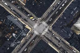
Traffic congestion is a huge problem in urban areas. In Stockholm, car owners spend about 16 workdays stuck in traffic each year. Public transport is also affected by this, and during rush hours, bus services can suffer huge delays.
The objective of the Spatial Modelling Analytics & Real-time Tracking (SMART) Mobility Project is to mitigate growing urban traffic congestion challenges and associated issues of environmental degradation, economic inefficiency and negative impacts to the quality of life of citizens.
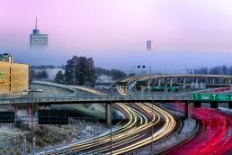
SMART Mobility will revolutionise the efficiency of traffic and commuting in cities by leveraging the capabilities of new 4D spatial technology and analysis platforms using real-time vehicle location and various movement data.
Several data sets
The project will use data from many different sources, including:
- Wifi data from Bumbee Labs. Position data is collected when smartphone searches for WiFi-connectivity. Bumbee Labs technologies utilizes this for crowd measurements and pedestrian flow, which is compliant with GDPR regulations.
- Vehicle data from Ramboll, Inrix and Tomtom. Through GPS, data such as speed and route can be obtained.
- Crowd data from Tre. Anonymize crowd data obtained from different sources, like cellular data and WiFi.
Project period
2020-2022
Partners
Ramboll
Bumbee Labs
Savantic
Tre
RISE
Contact
Eleonor Sjödin Turah
eleonor.sjodinturah@kista.com
Summary
SMART is a project that aims to create more effective traffic planning, with focus on public transport. The project will result in a prototype for a new platform, where many different data sets will interplay with AI technologies to predict congestion and plan routes accordingly.
The platform
The platform will be open and transparent for information and data exchange. The data sets can then be used for new types of services and applications, such as new routes for public transport and analyzing the size of a bus fleet. Through visualisation, this can be used to plan for a more effective public transport. In the end, this will benefit the end users – the travellers.
The project
The project aims to:
- Conduct three use cases in the Kista-Järva area
- Build the SMART-platform
- Integrate data sets into the platform
The anticipated result of the project is to completely integrate siloed data using 4D location. A real-time, shared and collaborative application platform will give access to multiple stakeholders. Furthermore, SMART will optimize mobility in the existing transportation network on a massive scale
Subscribe to newsletter
Error: Contact form not found.